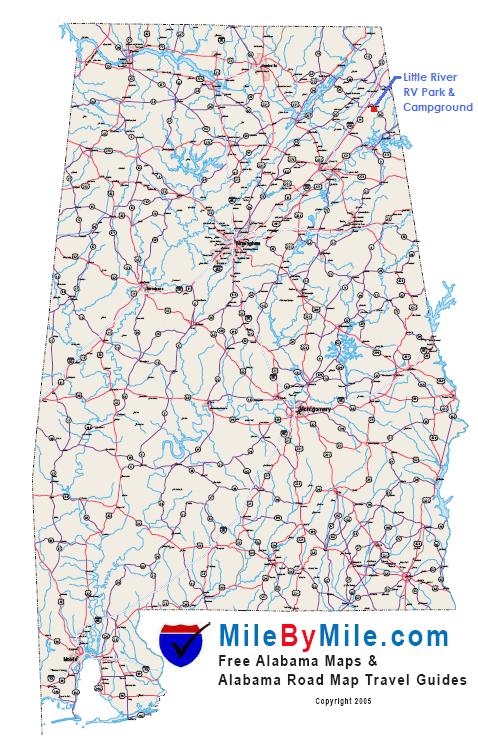
Northwest
from Huntsville, AL
(Click Here to
View Mapped Route)
Start at
Int. I-565 & U.S. 72 at Huntsville,
AL
Merge onto U.S. 72 E toward
Scottsboro, AL (40 miles +/-)
Merge onto AL. 35 S toward Fort
Payne, AL (2 miles +/-)
Turn right onto AL. 35 S toward
Fort Payne, AL (25 miles +/-)
Turn left onto U.S. 11/AL. 35/Gault
Ave. (1 mile +/-)
Turn right onto 5th St. NE/AL. 35 (6 miles
+/-)
Turn right onto DeKalb Co. Rd. 261 (1/4 mile
+/-)
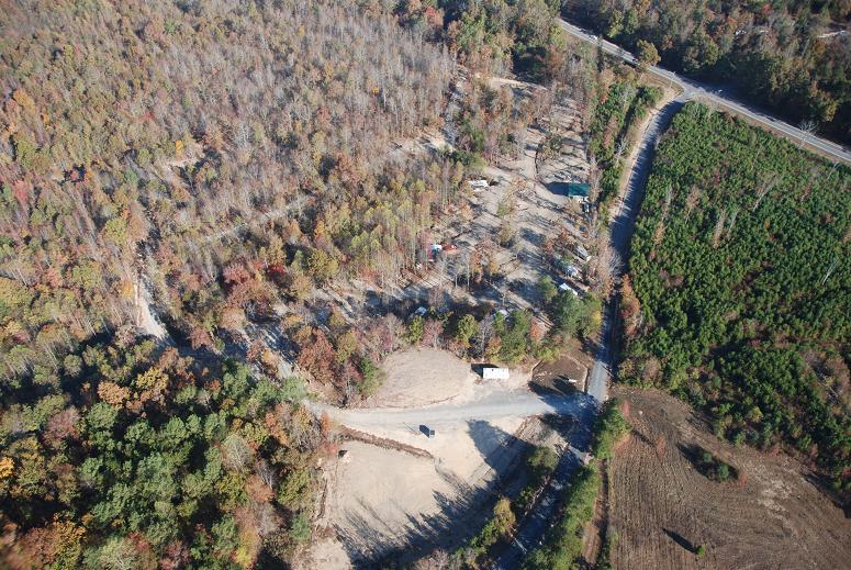
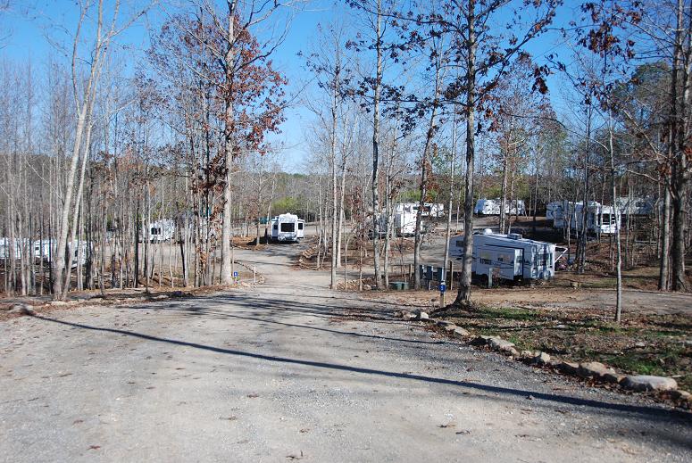
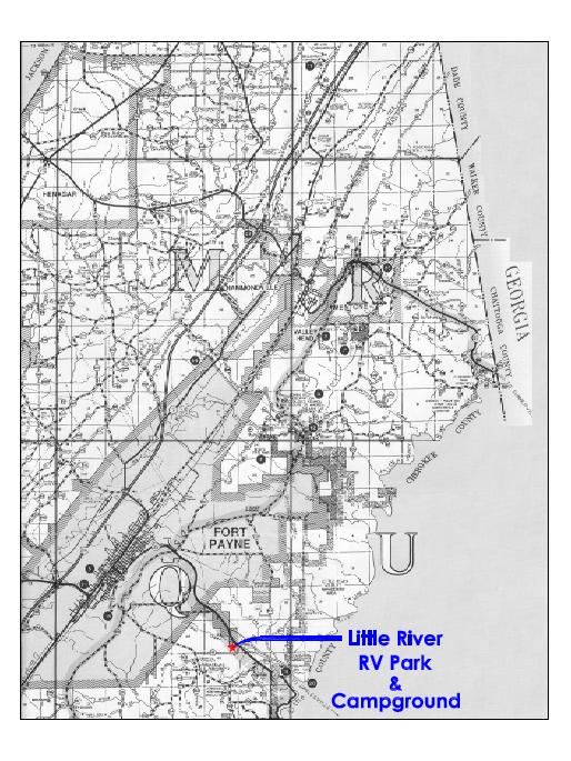
End at Little
River RV Park & Campground Entrance
|
Northeast
from Chattanooga, TN
(Click Here to
View Mapped Route)
Start at I-24
W at Chattanooga, TN
Merge onto I-24 W toward Nashville,
TN (5 miles +/-)
Merge onto I-59 via Exit 167 on the
left toward Birmingham, AL (39 miles
+/-)
Take U.S. 11 exit, Exit 222, toward
Fort Payne, AL (1/8 mile +/-)
Turn left onto U.S. 11/Greenhill
Blvd. NW (3 miles +/-)
Turn left onto 5th St. NE/AL. 35 (6 miles
+/-)
Turn right onto DeKalb Co. Rd. 261 (1/4 mile
+/-)
End at Little
River RV Park & Campground Entrance
|
Southwest
from Birmingham, AL
(Click Here to
View Mapped Route)
Start at Int.
I-59 & Roebuck Parkway at Roebuck,
AL
Merge onto I-59 N toward Gadsden,
AL (84 miles +/-)
Take AL. 35 exit, Exit 218 toward
Fort Payne, AL (1/4 mile +/-)
Turn right onto AL. 35 S toward
Fort Payne, AL (1/2 mile +/-)
Turn left onto U.S. 11/AL. 35/Gault
Ave. (1 mile +/-)
Turn right onto 5th St. NE/AL. 35 (6 miles
+/-)
Turn right onto DeKalb Co. Rd. 261 (1/4 mile
+/-)
End at Little
River RV Park & Campground Entrance
|
Southeast
from Atlanta, GA
(Click Here to
View Mapped Route)
Start at Int.
I-75 N & Chastain Rd. NW at Atlanta,
GA
Take GA. 113/Main St. exit, Exit
288, toward Cartersville, GA (1/4 mile
+/-)
Keep right at fork (0.0
miles)
Turn left onto GA. 113 S/E Main St.
(1 1/2 miles +/-)
Turn right (1/8 mile
+/-)
Turn right onto U.S. 41/GA. 3 N (5 miles
+/-)
Merge onto U.S. 411 S/GA. 20 W
toward Rome, GA (19 miles +/-)
Merge onto U.S. 27 N/GA. 20 W
toward Rome, GA (1 mile +/-)
Turn left onto E 2nd Ave. SW (2 miles
+/-)
Stay straight to go onto GA. 101 (1/8 mile
+/-)
Turn left onto Shorter Ave. NW/GA.
20 and continue on GA. 20 until
crossing over into Alabama were GA. 20 becomes
AL. 9 (17 miles +/-)
Turn right onto AL. 35 (15 miles
+/-)
Turn left onto DeKalb Co. Rd. 261 (1/4 mile
+/-)
End at Little
River RV Park & Campground Entrance
|